Chichester Local Plan 2021-2039 - Main Modifications consultation
Chapter 3: Spatial Strategy
Spatial Strategy
MM6 View responses
Para 3.9
Amend paragraph:
The Plan includes the allocation of two sites within the Southern Gateway for 180 dwellings and associated retail and leisure uses, as well as recognising that 270 dwellings could come forward on smaller, mainly brownfield sites, within the city (to be allocated through either the neighbourhood plan or site allocations DPD).
Para 3.19
Amend paragraph:
To the north of the A27, there are a series of small villages and hamlets interspersed with farmland and woodland. This area provides a transition into the South Downs National Park. Opportunities for development in this area appear to be limited due to land availability, landscape considerations, including the setting of the National Park, settlement patterns and available infrastructure. For these reasons, the Plan does not propose to provide for any significant development in these areas. This position will be kept under review as the Plan moves forward. The Plan does provide for 30 dwellings in the service village of Westbourne and 50 dwellings at Boxgrove, which is also a service village, to come forward through the neighbourhood planning process.
Para 3.21
Amend paragraph:
The north of the plan area covers those parts of Chichester District which lie northof the South Downs National Park boundary and includes its setting. This includes Loxwood Parish and most of the parishes of Kirdford, Plaistow and Ifold, and Wisborough Green, together with a small part of Lynchmere Parish close to the Surrey border around the villages of Camelsdale and Hammer.
Policy S1
Amend criterion 3.
Remove number from Point 7 and re-align to left margin.
Delete last sentence.
Remove footnote 16.
Additional sentence at end of Policy.
Policy Text Update:
Policy S1 Spatial Development Strategy
The spatial development strategy identifies the broad approach to providing sustainable development in the plan area. It seeks to disperse development across the plan area by:
- Focusing the majority of planned sustainable growth at Chichester city and within the east-west corridor,
- Reinforcing the role of Manhood Peninsula as a home to existing communities, tourism and agricultural enterprise, and
Where opportunities arise, sSupporting the villages and rural communities in the North of the Plan Area.
To help achieve sustainable growth the council will:
- Ensure that new residential and employment development is distributed in line with the settlement hierarchy, with a greater proportion of development in the larger and more sustainable settlements:
|
Strategic Development Location |
|
|
Within or adjacent to the sub-regional centre of Chichester city |
Shopwyke (Policy A7) West of Chichester (Policy A6) Westhampnett (Policy A9 and Policy A10) East of Chichester (Policy A8) Southern Gateway (Policy A4 and Policy A5) Chichester City (Policy A2) Land South of Bognor Road (Employment) (Policy A20) |
|
At the following settlement hubs |
Southbourne (Policy A13) Tangmere (Policy A14) |
|
At the following service villages |
Bosham (Policy A11) Hambrook / Nutbourne (Policy A12) Loxwood (Policy A15) |
- Non-strategic provision is made for the following forms of development in the settlement hubs of Selsey and East Wittering:
- Retail development and local community facilities of an appropriate scale to promote the vitality and viability of the town centres;
- Employment, tourism or leisure proposals of a suitable scale and nature for the characteristics of the area;
- Non-strategic provision is made for the following forms of development in service villages:
- Small-scale housing developments consistent with the indicative housing numbers set out in Policy H3;
- Local community facilities, including village shops, that meet identified needs within the village, neighbouring villages and surrounding smaller communities, and will help make the settlement more self-sufficient; and
- Small-scale employment, tourism or leisure proposals.
- Provision for the above is made through this Local Plan, the extant Site Allocation Development Plan Document 2014-2029 (or subsequent Site Allocation DPD) and through neighbourhood plans16.
To ensure that the council delivers its housing target, the distribution of development may need to be flexibly applied, within the overall context of seeking to ensure that the majority of new housing is developed in accordance with this Strategy where appropriate and consistent with other policies in this plan. Any changes to the distribution will be clearly evidenced and monitored through the Authority Monitoring Report.
Additional housing allocations, if required, will be made through the Site Allocation DPD (or review of the Local Plan).
16See Appendix H for detail on saved Site Allocation DPD
MM7 View responses
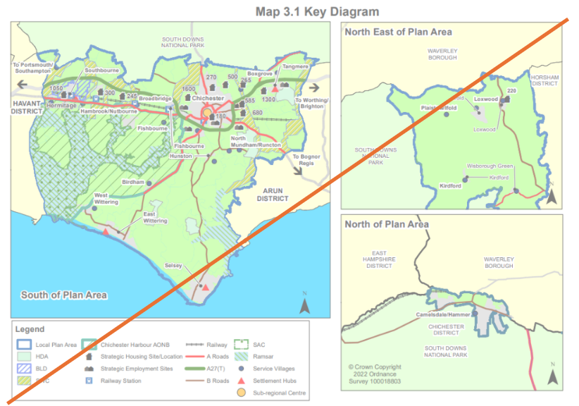
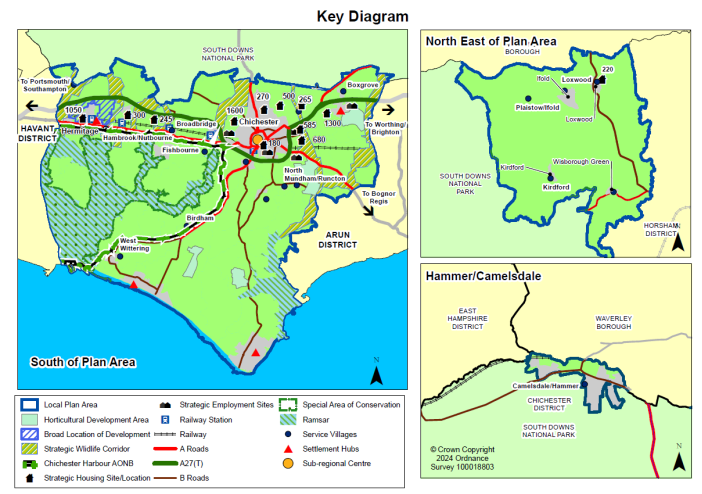
Map 3.1 Key Diagram
Remove strategic employment site icon for SW Chichester
Chichester Harbour AONB boundary not clear where it is overlaid with roads - make boundary clearer

